Coordination between air and ground, efficient control | DJI Asso
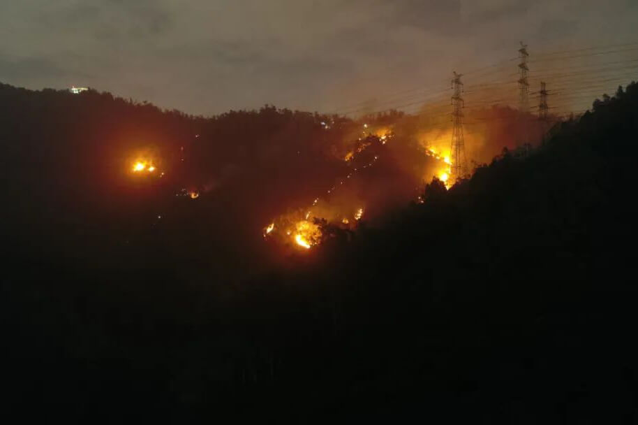
1 The moon, the moon 21 Oh, God. Oh, God. 20 Hour 20 A mountain fire broke out in Danan Mountain in Shenzhen. Taking advantage of the terrain and wind, the fire spread rapidly to the top of the mountain. Danan Mountain is full of shrubs, fast trees and weeds, and the fire is very rapid for a while. Nearby is exactly 220kV High-voltage power grid, the scene situation is not relaxed for a moment.
Emergency Rescue Alliance, Emergency Rescue Alliance, Emergency Rescue.

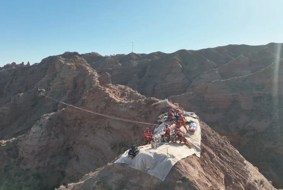
Direct click on the spot method
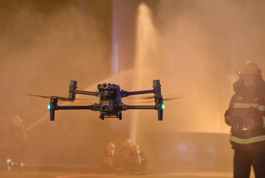
The latitude and longitude of Xinjiang. M300 RTK The drone is in 2 The decoration equipment is completed within minutes, take off quickly, go deep into the fire scene, and the real-time screen is directly connected to the big screen of the front command to help fire officers and fighters study and judge the fire situation, efficiently configure the fire force on the ground, and provide efficient guarantee for sumo wrestling rescue.
Wide-horned bird overview
This time the hill fire is typical."going up the mountain fire" usually adopts the strategy of "attacking from the fire wing, cutting off the line of fire, and annihilating by stages". When the first-line corporals advance on the top of the mountain, the rear that was originally extinguished may reignite, or a flying fire may be brought by strong winds. Once it burns, the fire will affect the way back for rescue workers and cause certain safety risks.

In the process of extinguishing the fire, the wide-angle lens of the UAV always covers the whole scene of the fire, taking a bird's-eye view of the overall situation, regardless of any important changes.

When the drone screen shows a resurgence in the rear, the command officers and soldiers immediately locate the fire point, connect to the front, and give a timely warning to avoid being surrounded by a first-line corporal fire. Under the direction of the headquarters, a number of small fires were quickly suppressed.
High-definition infrared, locate the source of fire
It is not easy to accurately evaluate the situation of fire at night, especially when it is covered by thick shrubs, such as hill fire. The thermal imaging phase function converts the thermal information into a visible view, which directly reflects the temperature difference of the region.

In this hill fire, fire officers and fighters used thermal imaging cameras mounted by drones to locate the fire source directly and accurately through the temperature difference, saving valuable time for fire fighting and quickly curbing the spread of the fire.
Efficient and urgent lifting of the ban to ensure the security of airspace
As the fire release is located in the UAV control zone, it is also within the no-fly zone in Xinjiang. The emergency rescue operation has been granted a legal permission to operate in the airspace, which does not affect the normal operation of civil aircraft, and at the same time allows the alliance between drones and helicopters to achieve alliance. DJI Emergency Rescue Alliance quickly passed the Shenzhen UAV integrated management system.(UTMISS)The airspace application for the application of urban fire-fighting drones was submitted to the military and civil aviation.
The Air Force Air Traffic Control Office of the Southern Theater, the Shenzhen Supervision Bureau of Civil Aviation, and the Shenzhen Air Traffic Control Station of Civil Aviation quickly approved the approval, and DJI responded to the lifting of the ban on drones in accordance with the after-sale approval.

Under the joint command of the Shenzhen Civil Aviation Regulatory Administration, the air traffic control station, the Shenzhen Tower, and the Nanshan District Public Security Bureau, helicopters and drones have an orderly division of labor, cooperate with tacit understanding, and maintain different levels of on-site rescue command and dispatch. outstanding to ensure the emergency rescue mission.

After the open fire was put out, DJI drones still guarded the fire from high altitude to prevent rekindling, and electric power companies were assigned to check the hidden dangers of blood transfusion lines near the affected area.
Deepen the application and serve the actual combat. DJI career response will start with first-line demand, help enhance the emergency rescue state awareness of front-line personnel, and reduce the burden and efficiency of emergency rescue work with scientific and technological innovation.
Other News
-
 Cluster modeling, air-to-ground cooperation, DJI UAV efficient co2024-09-21
 -
 Coordination between air and ground, efficient control | DJI Asso2024-09-21
 -
 How to respond quickly after an earthquake? Emergency missio2024-09-21
 -
 How did drones become the core rescue tool in the2024-09-21
 -
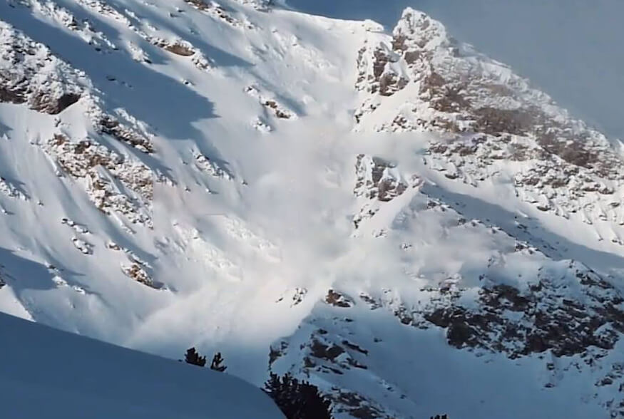 There was a sudden avalanche in the French ski resort,&2024-09-21
 -
 Latitude and longitude M30 System +Dajiang Sikong 2 Redefine the cooperatio2024-09-21