How did drones become the core rescue tool in the
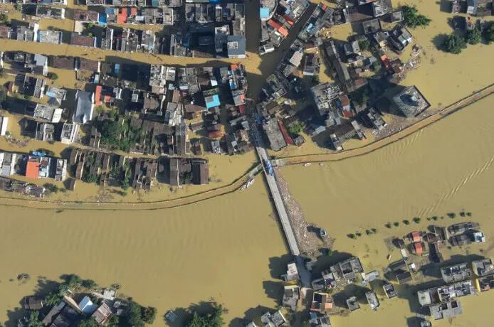
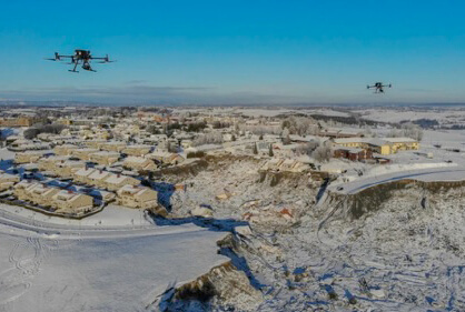
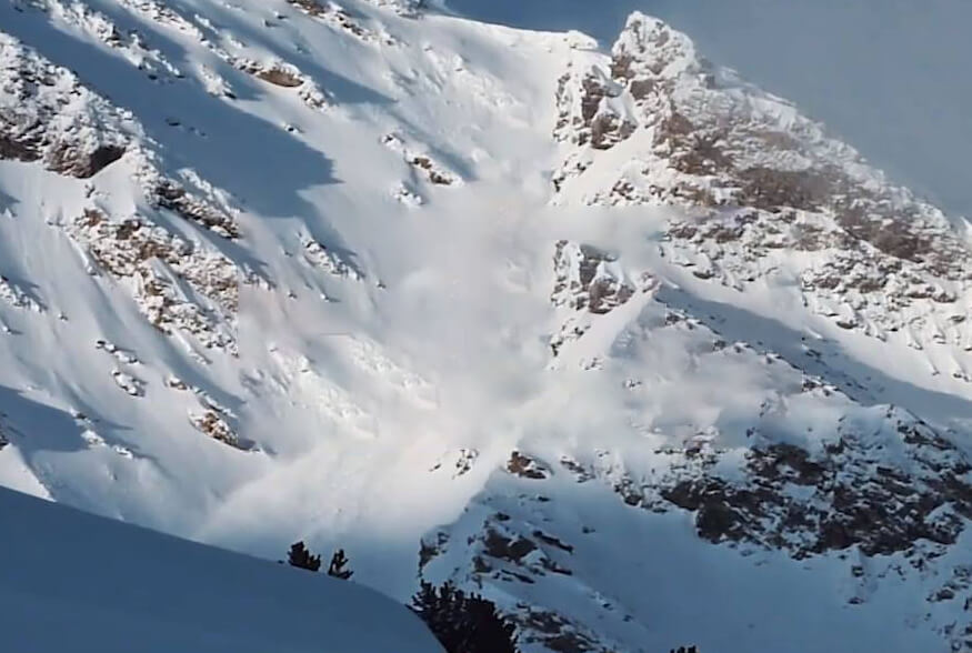
2020A year, a year12The moon, the moon30Early in the morning, Norway suffered the largest landslide in the country's history. The large collapse area is near. 2 Ask, nearby Ask(Ask)The village was badly hit.
Early in the morning. 4 The Norwegian emergency rescue team was alerted. At this time, the outdoor temperature is as low as below zero. 23°CHigh wind speed18.4Rice/The weather is extremely bad. Rescue workers need to be exhausted, the victims trapped in the rubble, and there is also the danger of a landslide.
Rescue captain Kenny·Osserud. Osserud.(KennyÅserud)This is the most difficult rescue mission in the history of the Norwegian emergency rescue team.
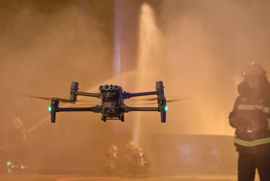
Rescue workers speed department longitude and latitude M300 RTK A drone; a drone.
The rescue team quickly divided a number of Xinjiang longitudes and latitudes. M300 RTK Drones, overcoming the effects of low temperatures and strong winds, combine air and ground, locate and rescue survivors. After the rescue work has been consolidated, 40 God, DJI drones provide more than 270 It is also the largest drone rescue operation in Europe.
Infrared thermal imaging, open the night rescue channel.
12Norway is in a short time during the day, and there is only a short time in the day.6An hour. How to solve the problem of limited vision at night and test all rescue workers. The latitude and longitude of Xinjiang. M300 RTK The drone is loaded with meditation. H20T Opened the night rescue channel.
Night search drones
Infrared thermal imaging cameras collect the number of affected areas from the air. Within an hour of the drone landing, the first infrared 3D model of the disaster area was generated and synchronized for use by all rescue workers. The rescue team said the infrared model is critical to the operation because it provides a global sense of the state and allows rescuers to operate safely in the dark. In addition, because the size of the infrared photo is relatively small, the maximum collection shortens the time to build the mode.
Drones seek help at night
With the in-depth development of rescue work, thermal imaging plays a key role in investigation. The command center continuously monitors the thermal imaging images returned by the unmanned machine, the temperature difference between acquaintances and building cement and snow, and the victims who are found difficult or buried in time.
UAV and helicopter "search" and "rescue", cooperate tacit understanding
In rescue operations, helicopters are often used to quickly detect and pick up victims. In reconnaissance, the helicopter has a narrow field of vision and limited flexibility. In addition, the original flow of helicopter rotor blades is large, which is very likely to cause debris of destroyed houses and debris, posing a threat to the safety of rescue workers.
In this search and rescue operation, the division of labor between the UAV and the helicopter is clear: the UAV quickly detects, locates and hunts the target, and synchronizes to the helicopter to guide the helicopter to rescue the victims.
UAV and helicopter work together
DJI Pilot APP Align multi-dimensional numbers on the same interface
Greatly improve work safety
Latitude and longitude M300 RTK The number of software interfaces of telecontrol is not rich, and the obstacle avoidance information is clear and accurate, which makes the cooperation between UAV and helicopter easier. Because the two often operate in the air, in shared airspace. Detailed navigation and avoidance letters reduce the risk of interaction between different types of aircraft.
In the rescue operation. 20 Many hours later, the UAV identified a puppy through thermal imaging. It took an hour for the rescue helicopter to reach the dog's position, and rescuers directed it through. M300 RTK Continue to wander in the air and turn on searchlights for straight-up navigation until the puppy is safely rescued.
The UAV monitors the disaster area to ensure the safety of rescue workers.
After the landslide, survivors and rescue workers are facing the wind of the landslide. After the rescue team has set up a route, it will let it pass by. M300 RTK On a regular basis, multiple building patterns are used to compare the original images of the actual coordinates to alert rescuers to the movement of the landslide zone or other changes, and to prepare in advance to avoid dangerous areas.
Modeling of disaster area by Dajiang Unmanned aerial vehicle
The fixed number of spaces in this rescue operation, analyst. Dan Richard Isdahl-Engh Highly affirmed the aerial survey capability of the UAV: "it is unprecedented to obtain such an accurate, real-time, high-resolution disaster area model in this short period of time."
If this is the case, it can be judged by waiting for the orthographic image of the satellite camera. It is not very convenient and the resolution is low. In such cloudy and cloudy weather, the use of satellite images is even more limited. The low-altitude perspective of the UAV provides an excellent solution.
Continuous high-intensity work is a huge test for the performance of drones. The latitude and longitude of Xinjiang. M300 RTK The flight time is as long as55It only takes two sets of batteries to work seamlessly.
The command center is studying the UAV return screen.
The Norwegian emergency rescue team submitted that one of the most valuable values of drones provides situational awareness for rescuers, based on a comprehensive understanding of the scene, so that rescuers can act more effectively and ensure their own safety.
Firefighters, police, unmanned cockpit personnel, helicopter pilots, analysts and even local residents were involved in the rescue operation after the landslide in Norway. Behind them, the number of sites provided by drones strung together rescue forces from all sides to help them complete their respective missions and guard their safe return.
Material source:
Anders Martinsen(UAS Norway)
Other News
-
 Cluster modeling, air-to-ground cooperation, DJI UAV efficient co2024-09-21
 -
 Coordination between air and ground, efficient control | DJI Asso2024-09-21
 -
 How to respond quickly after an earthquake? Emergency missio2024-09-21
 -
 How did drones become the core rescue tool in the2024-09-21
 -
 There was a sudden avalanche in the French ski resort,&2024-09-21
 -
 Latitude and longitude M30 System +Dajiang Sikong 2 Redefine the cooperatio2024-09-21